And the GIS Data?
VI - What About the Euratlas Georeferenced Historical Source Maps?
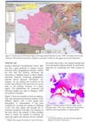
The Euratlas Periodis historical atlas has been created and maintained by Christos Nüssli since 1996 with Corel Draw, a vector graphic editor. The vector maps have been converted to a geographic information system (GIS) database, the Euratlas Georeferenced Historical Vector Data, by Marc-Antoine Nüssli since 2006. These GIS data sets are now available for sale, especially to educational or research institutions, publishers or museums.
1) Would you provide information about the attributes that are part of the 1700, 1800 and 1900 data sets? Are the country boundaries in a polygon format?
Yes the boundaries are in a polygon format but you'll find more information by following this link: www.euratlas.net/tele/euratlas_HGIS.pdf. If you have additional technical questions, please ask directly Marc-Antoine .
2) Are you planning to create boundaries for additional years in-between the ones you have done?
We are planning to create boundaries further behind in the Antiquity, but not yet for the modern in-between years.
3) The license agreement for the Euratlas Georeferenced Historical Vector Data states that the data is to be used for internal use. For a publication, do I need to request your written consent. Therefore, is it possible to get an educational or cultural use license for the 1700 data, and if there is an additional license cost for a single figure in an academic publication?
It is important to know the number of copies of the manuscript. If there are planned less of 1500 copies, you can use the map to illustrate the work with the mention of copyright as provided in clause 10. If there will be more than 1500 copies, please let us know : 1) how many copies? 2) where and how the manuscript will be disseminated?
4) I have purchased your Georeferenced Historical Vector Data 1500. The data description file says the "size" variable codes the "importance/size of the city" in five categories. Could you provide more detail on how cities were sorted?
The importance of the antique and medieval cities is a difficult problem. We cannot simply take into account the population number of a town because several outlying (Scandinavia, Africa, Russia etc.) places would at once disappear from the map, neither can we consider mainly the historical significance of small places (like Quierzy-sur-Oise e.g.) because that would be inconsistent. Moreover, before the 16th cent., it's quite impossible to know all the inhabited places in Europe and the population estimations are tremendously varied: e.g. less than 50 000 persons for Cordoba in AD 1000 according to Colin Mc Evedy but 500 000 to 700 000 according to The Times Atlas of World History. For all these reasons, there is no strict formal criterion for the importance of the cities. We have mixed the usual data of the common historical atlases mentioned in the sources with the necessities of history (battle places etc..). However the user can change the names and importance of the cities according to his own field by adding or eliminating some places. Nevertheless, here are our relative criteria, for the ranking: 1 = some villages or landmarks (ruins etc.) worth to be mentioned for historical reasons, 2 = existing inhabited places of lesser importance, 3 = medium or unclear importance cities, 4 = important cities, 5 = big and important cities that can't be avoided in a specific century.
5) We are a book publishing institute and we are about to publish a book which contains a journey. We've searched for a map to attach the book and found an adequate map at your site. The map is under the link: www.euratlas.com/travel_time/europe_south_east_1800.html. Can you send us a high resolution graphic file (200-300 dpi) and if so how much does it cost ?
We propose you acquire an utilisation license for the Georeferenced Historical Vector Data 1800. Thus you will be allowed to use the vectorial data, alone or combined with other date and to publish the map for the price of 150 euros (simple license for 1500 copies) or 600 euros (extended license without limitation of the number of copies). Please see the link shop euratlas.com/maps_gis/gis_1800.html. You can also buy Euratlas Periodis Expert, which costs 55 euros. In this case, you have to pay author rights depending of the type of book and the number of published copies. If you give us this information, we can tell you the final price. See the link www.euratlas.net/shop/history_atlas/periodise_en.html.
6) I would be interested in a license for either 1500, 1600, 1700 and 1800 or perhaps the entire work. However the license only allows the presentation of vector data as bitmaps. I would build dynamic maps presented as vector data that would be secure and would not be downloaded. Is it possible?
Concerning the presentation of vector maps built from our data, there are different aspects. First, it depends on who will have access to the maps and on which license you buy. Indeed, if you have a site-license for your university and that the maps are available only to your members, then there is no issue at all. Now, if you want to give access to external people or you just have a simple license, then it depends on which kind of framework you use. If you use a WMS-like(such googlemaps) service, i.e. a system where the server generates bitmap images on demand and send them to the clients for display, then there is no problem as only bitmap data are delivered to the clients. On the other hand, if you use WFS-like system, which send geographical features to clients, then it is a bit more problematic. I don't know how Flex works but I think that it should be possible to do with WMS. Do you know about these technical details for Flex? If not, I can find some information. Otherwise, if you really need to send vector data to the clients(i.e. use a WFS-like system) then we could discuss for an arrangement.
Finally, note that in any case, with a simple licence, there is some limitation on the possibility of external publications or presentation. You can find the complete text license at
www.euratlas.net/shop/licences/licence_gis_gb.pdf but basically, you are limited to 1500 CDroms or paper copies of a publication and to presentation on website with less than 500'000 visitors per month. However, you can ask for an exemption of those limits in the case of academic works/publications.
7) Do you ever sell data to an educational institution?
Educational institutions are specially interested in the Euratlas Historical GIS Data. We have sold it in particular to U.S. Universities like Harvard University, Ohio University, Princeton University, University of Portland and Stanford and to European Universities like the University of Kent and the National and Kapodistrian University of Athens.
8) We are developing an online encyclopedia about European history at the time of the Habsburg monarchy and need the Georeferenced Historical Vector Data from 1200 to 2000 simple license. Is there any package available or discount possible when buying all the licenses together?
If you purchase several simple licenses together, we can make the following discount : 20 % for 9 licenses and 25 % for the full set. If you purchase 9 extended licenses: 25 % and 30 % for the full set or site license. The simple license concerns the use of the data on an Internet site, to which the usual number of visitors does not exceed 500,000 a month. Please see the license text here: www.euratlas.net/shop/licences/licence_gis_gb.pdf. We assume that you have tested the sample files of the Georeferenced Historical Vector Data, available from every product page: www.euratlas.net/shop/maps_gis/gis_1200.html or www.euratlas.net/shop/maps_gis/gis_1300.html etc..
See also the article
From Historical Mapping To Historical Geographical
Information System

PDF format
or the presentation

PDF format
Periodical Historical Atlas of Europe
according to your needs